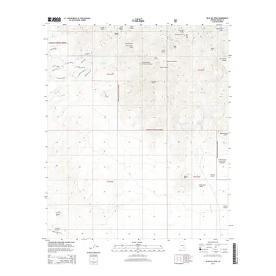
2014 Map of Blue Jay Peak
USGS Topo · Published 2014About this map
The Pinaleno Mountains dominate this high-desert landscape within the Coronado National Forest. Centered on Blue Jay Peak, the map reveals a rugged network of drainage systems and ridge lines, including Johns Canyon Ridge and Blue Jay Ridge. Human impact is sparse but historically significant, noted by the isolated Lindsey Grave and several water management features vital for ranching and survival in this arid environment, such as Lindsey Tank, Van Valer Tank, and Stansberry Number Three Tank.
Find a feature on this map
53 named features on this map. Tap any name to fly to it.
Don’t see what you’re looking for? This feature index may not catch every label — zoom into the map to look around manually.
Map Details
Editions of this 2014 Blue Jay Peak Map
This is the sole edition of this map. No revisions or reprints were ever made.
Other maps of this area

1940 · Sierra Bonita Ranch
USGS Topo · 1:62,500

1942 · Sierra Bonita Ranch
USGS Topo · 1:62,500

1942 · Mt. Graham
USGS Topo · 1:62,500

1943 · Sierra Bonita Ranch
USGS Topo · 1:62,500

1944 · Jackson Mtn.
USGS Topo · 1:62,500

1945 · Mt. Graham
USGS Topo · 1:62,500

1946 · Jackson Mtn.
USGS Topo · 1:62,500

1954 · Silver City
USGS Topo · 1:250,000

1956 · Tucson
USGS Topo · 1:250,000

1958 · Silver City
USGS Topo · 1:250,000