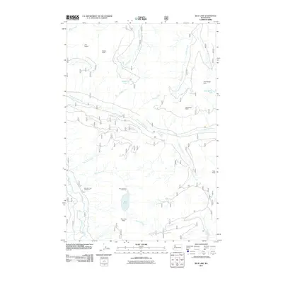
2011 Map of Blue Lake
USGS Topo · Published 2011About this map
Blue Lake sits at the center of this mountain landscape in Lewis County, dominated by a dense network of watercourses and high ridgelines. The hydrology is defined by the Cispus River and its North Fork, which collect numerous tributaries such as Timonium Creek, Cat Creek, and Suede Creek. High points like Castle Butte and the Twin Sisters provide significant vertical relief, while the presence of the Blue Lake Creek Campground and Blue Lake Camp Picnic Area indicates the area's established role for outdoor recreation within the forest. Smaller alpine water bodies, including Jackpot Lake and Saint Michael Lake, are tucked into the higher elevations. A complex system of forest roads, including those managed by the U.S. Forest Service, traverses the terrain, connecting Horseshoe Point and Cozy Ridge to the lower river valleys.
Find a feature on this map
24 named features on this map. Tap any name to fly to it.
Don’t see what you’re looking for? This feature index may not catch every label — zoom into the map to look around manually.
Map Details
Editions of this 2011 Blue Lake Map
This is the sole edition of this map. No revisions or reprints were ever made.
Other maps of this area

1924 · Mt Rainier
USGS Topo · 1:96,000

1926 · Steamboat Mtn
USGS Topo · 1:125,000

1928 · Mt Rainier
USGS Topo · 1:125,000

1931 · Steamboat Mtn
USGS Topo · 1:125,000

1950 · Yakima
USGS Topo · 1:250,000

1958 · Yakima
USGS Topo · 1:250,000

1961 · Yakima
USGS Topo · 1:250,000

1962 · Randle
USGS Topo · 1:62,500

1962 · Packwood
USGS Topo · 1:62,500
1965 · Tower Rock
USGS Topo · 1:24,000