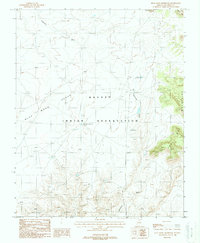
1988 Map of Blue Moon Reservoir
USGS Topo · Published 1988About this map
Navajo Indian Reservation lands in Coconino County define this arid high-desert landscape, dominated by the prominent expanse of the Blue Moon Bench. The 1988 survey captures a terrain shaped by seasonal water management and dramatic geological formations, where the drainage of Tatahatso Wash and Bekihatso Wash carve through the plateau. A network of small, essential water sources is documented, including the Blue Moon Reservoir, Big Reservoir, and Curve Reservoir. To the east, the rising elevations of the Bodaway Mesa and the sheer verticality of the Echo Cliffs provide a stark boundary to the bench. Evidence of local pastoral activity is noted simply by a Corral and Horse Reservoir, marking the sparse but vital infrastructure utilized on the reservation during this era.
Find a feature on this map
12 named features on this map. Tap any name to fly to it.
Don’t see what you’re looking for? This feature index may not catch every label — zoom into the map to look around manually.
Map Details
Editions of this 1988 Blue Moon Reservoir Map
This is the sole edition of this map. No revisions or reprints were ever made.
Other maps of this area

1886 · Echo Cliffs
USGS Topo · 1:250,000

1891 · Echo Cliffs
USGS Topo · 1:250,000

1907 · Vishnu
USGS Topo · 1:48,000

1954 · Shinumo Altar NE
USGS Topo · 1:24,000

1954 · Shinumo Altar SE
USGS Topo · 1:24,000

1954 · Nankoweap
USGS Topo · 1:62,500

1954 · Shinumo Altar
USGS Topo · 1:62,500

1955 · Blue Spring NE
USGS Topo · 1:24,000

1955 · Blue Spring
USGS Topo · 1:62,500

1956 · Marble Canyon
USGS Topo · 1:250,000