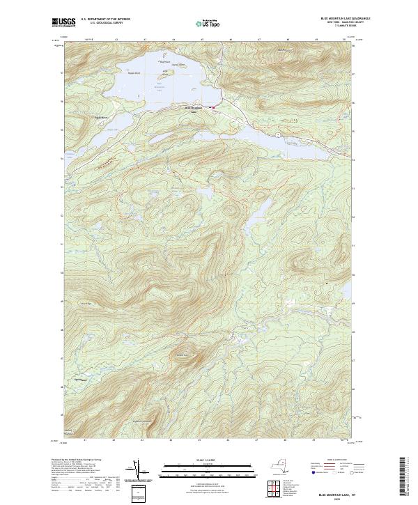
2023 Map of Blue Mountain Lake
USGS Topo · Published 2023About this map
High peaks and interconnected waterways dominate this pocket of the Adirondacks, where the settlement of Blue Mountain Lake serves as a central hub. The landscape is defined by its massive topographical relief, rising sharply from the lake shores to the summit of Blue Mountain. To the west, the historic Eagle Nest estate area sits between the eponymous Eagle Lake and Utowana Lake, connected by the narrow corridor of Rock River.
Find a feature on this map
41 named features on this map. Tap any name to fly to it.
Don’t see what you’re looking for? This feature index may not catch every label — zoom into the map to look around manually.
Map Details
Editions of this 2023 Blue Mountain Lake Map
This is the sole edition of this map. No revisions or reprints were ever made.
Other maps of this area

1899 · Indian Lake
USGS Topo · 1:62,500

1900 · Canada Lake
USGS Topo · 1:62,500

1902 · Indian Lake
USGS Topo · 1:62,500

1903 · West Canada Lakes
USGS Topo · 1:62,500

1903 · Raquette Lake
USGS Topo · 1:62,500

1903 · Blue Mountain
USGS Topo · 1:62,500

1950 · Utica
USGS Topo · 1:250,000

1954 · Blue Mountain
USGS Topo · 1:62,500

1954 · Indian Lake
USGS Topo · 1:62,500

1954 · West Canada Lakes
USGS Topo · 1:62,500