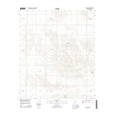
2014 Map of Blue Plateau
USGS Topo · Published 2014About this map
Blue Plateau and the Sand Tank Mountains dominate this high desert region in southern Arizona as it appeared in 2014. This USGS survey details the complex topography of the Sonoran landscape, where steep ridgelines and narrow canyons are clearly defined by 40-foot contour intervals. Notable landmarks such as Round Butte and the curiously named Jack in the Pulpit provide essential navigation points across the dry terrain. The map is organized through the Public Land Survey System, showing several townships including t7s r3w and t8s r3w. While no major settlements or highways cross this specific quadrant, the intricate network of peaks and drainage patterns illustrates the untouched character of Maricopa County’s desert interior during the early 21st century.
Find a feature on this map
13 named features on this map. Tap any name to fly to it.
Don’t see what you’re looking for? This feature index may not catch every label — zoom into the map to look around manually.
Map Details
Editions of this 2014 Blue Plateau Map
This is the sole edition of this map. No revisions or reprints were ever made.
Other maps of this area

1951 · Estrella
USGS Topo · 1:62,500

1951 · Gila Bend
USGS Topo · 1:62,500

1953 · Ajo
USGS Topo · 1:250,000

1957 · Ajo
USGS Topo · 1:250,000

1958 · Ajo
USGS Topo · 1:250,000

1958 · Kaka
USGS Topo · 1:62,500

1958 · Hat Mountain
USGS Topo · 1:62,500

1962 · Ajo
USGS Topo · 1:250,000

1963 · Ajo
USGS Topo · 1:250,000

1967 · Ajo
USGS Topo · 1:250,000