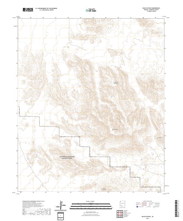
2021 Map of Blue Plateau
USGS Topo · Published 2021About this map
Sand Tank Mountains dominate this section of the Arizona desert, where steep elevation changes define the landscape south of the Gila River. The prominent Blue Plateau stands as a central landform, surrounded by distinct topographical markers such as the isolated peak of Round Butte and the curious formation labeled Jack in the Pulpit. The grid of the Public Land Survey System is clearly visible, marking the intersections of Township 6 South through Township 8 South and Ranges 2 West through 4 West. This 2021 update reflects the modern topographical state of this Maricopa County terrain, mapping the complex drainages and ridges that characterize this part of the Sonoran desert before it transitions toward the higher mountain ranges to the south.
Find a feature on this map
13 named features on this map. Tap any name to fly to it.
Don’t see what you’re looking for? This feature index may not catch every label — zoom into the map to look around manually.
Map Details
Editions of this 2021 Blue Plateau Map
This is the sole edition of this map. No revisions or reprints were ever made.
Other maps of this area

1951 · Estrella
USGS Topo · 1:62,500

1951 · Gila Bend
USGS Topo · 1:62,500

1953 · Ajo
USGS Topo · 1:250,000

1957 · Ajo
USGS Topo · 1:250,000

1958 · Ajo
USGS Topo · 1:250,000

1958 · Kaka
USGS Topo · 1:62,500

1958 · Hat Mountain
USGS Topo · 1:62,500

1962 · Ajo
USGS Topo · 1:250,000

1963 · Ajo
USGS Topo · 1:250,000

1967 · Ajo
USGS Topo · 1:250,000