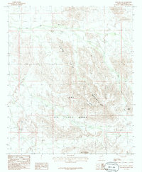
1986 Map of Blue Plateau
USGS Topo · Published 1986About this map
The Luke Mountains dominate this high-desert landscape in Maricopa County, characterized by the expansive Blue Plateau and prominent volcanic forms like Round Butte. Much of the territory falls within the Air Force Range, a designation that has historically limited public access and preserved the arid topography from significant civilian development. Drainage in this arid region is defined by ephemeral systems like Sand Tank Wash, which cuts through the complex terrain. Aside from a lone Radio Tower and the curiously named Jack in the Pulpit landmark, the area remains an open expanse of desert peaks and washes, reflecting its mid-1980s status as a remote military-managed corridor.
Find a feature on this map
7 named features on this map. Tap any name to fly to it.
Don’t see what you’re looking for? This feature index may not catch every label — zoom into the map to look around manually.
Map Details
Editions of this 1986 Blue Plateau Map
This is the sole edition of this map. No revisions or reprints were ever made.
Other maps of this area

1951 · Estrella
USGS Topo · 1:62,500

1951 · Gila Bend
USGS Topo · 1:62,500

1953 · Ajo
USGS Topo · 1:250,000

1957 · Ajo
USGS Topo · 1:250,000

1958 · Ajo
USGS Topo · 1:250,000

1958 · Kaka
USGS Topo · 1:62,500

1958 · Hat Mountain
USGS Topo · 1:62,500

1962 · Ajo
USGS Topo · 1:250,000

1963 · Ajo
USGS Topo · 1:250,000

1967 · Ajo
USGS Topo · 1:250,000