
1943 Map of Bluemont
USGS Topo · Published 1960About this map
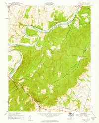
The eastern slopes of the Blue Ridge dominate the western edge of this 1940s landscape, where the Appalachian Trail winds through Snickers Gap and Bear Den Park. This area of Loudoun County is characterized by a network of small, established farming communities and crossroads settlements connected by winding country lanes. Towns such as Bluemont, Unison, and Bloomfield are centered around local institutions like Ebenezer Ch and the Unison Sch.
Find a feature on this map
32 named features on this map. Tap any name to fly to it.
Don’t see what you’re looking for? This feature index may not catch every label — zoom into the map to look around manually.
Map Details
Editions of this 1943 Bluemont Map
This is the sole edition of this map. No revisions or reprints were ever made.
Other maps of this area

1884 · Harpers Ferry
USGS Topo · 1:125,000

1891 · Harpers Ferry
USGS Topo · 1:125,000

1893 · Harpers Ferry
USGS Topo · 1:125,000

1894 · Warrenton
USGS Topo · 1:125,000

1916 · Berryville
USGS Topo · 1:62,500

1933 · Middleburg
USGS Topo · 1:62,500

1939 · Berryville
USGS Topo · 1:48,000
1943 · Ashby Gap
USGS Topo · 1:24,000

1943 · Upperville
USGS Topo · 1:24,000

1943 · Rectortown
USGS Topo · 1:24,000