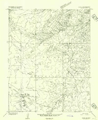
1952 Map of Bluff 3 SW
USGS Topo · Published 1954About this map
Navajo Indian Reservation lands dominate this mid-century survey of San Juan County, revealing a landscape defined by seasonal watercourses and limited transportation routes. The geography is carved by the deep drainages of Hilkito Wash and Eagle Rock Wash, while Gypsum Creek winds through the southeastern portion of the quadrangle. A remote network of infrastructure is evident in the presence of a lone Jeep Trail and the evocatively named Stage Coach Wash, suggesting the historic transit patterns of the Four Corners region before modern highway development. This preliminary edition, based on 1951 aerial photography, captures the intricate topography of the high desert plateau with high-resolution contour work, documenting the natural drainage patterns that have dictated movement through this territory for generations.
Find a feature on this map
8 named features on this map. Tap any name to fly to it.
Don’t see what you’re looking for? This feature index may not catch every label — zoom into the map to look around manually.
Map Details
Editions of this 1952 Bluff 3 SW Map
This is the sole edition of this map. No revisions or reprints were ever made.
Other maps of this area

1883 · Marsh Pass
USGS Topo · 1:250,000

1886 · Henry Mountains
USGS Topo · 1:250,000

1886 · Abajo
USGS Topo · 1:250,000

1892 · Marsh Pass
USGS Topo · 1:250,000

1892 · Abajo
USGS Topo · 1:250,000

1892 · Henry Mountains
USGS Topo · 1:250,000

1892 · Canyon De Chelly
USGS Topo · 1:250,000

1893 · Abajo
USGS Topo · 1:250,000

1952 · Bluff 3 SE
USGS Topo · 1:24,000

1952 · Dinnehotso
USGS Topo · 1:62,500