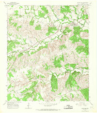
1965 Map of Bluff Dale
USGS Topo · Published 1967About this map
Bluff Dale serves as the primary hub of activity in this mid-1960s survey of eastern Erath County, situated along the North Paluxy River and the tracks of the Atchison Topeka and Santa Fe railroad. The landscape is defined by the convergence of several waterways, including the South Paluxy River and Richardson Creek, which carve through the terrain beneath landmarks like Pilot Knob. This area preserves a dense record of early rural settlement through its scattered places of worship and burial grounds. Genealogists and local historians can find the locations of Wesley Chapel Cem, Knob Hill Cem, and Acrea Cem, along with the Mt Zion Ch and Wesley Chapel. The presence of numerous Gravel Pits along the riverbanks suggests the local extractive industry that supported the region's development during this era.
Find a feature on this map
25 named features on this map. Tap any name to fly to it.
Don’t see what you’re looking for? This feature index may not catch every label — zoom into the map to look around manually.
Map Details
Editions of this 1965 Bluff Dale Map
Other maps of this area

1889 · Granbury
USGS Topo · 1:125,000

1890 · Stephenville
USGS Topo · 1:125,000

1920 · Stephenville
USGS Topo · 1:125,000

1931 · Tolar
USGS Topo · 1:62,500

1954 · Dallas
USGS Topo · 1:250,000

1954 · Abilene
USGS Topo · 1:250,000

1958 · Dallas
USGS Topo · 1:250,000

1958 · Abilene
USGS Topo · 1:250,000
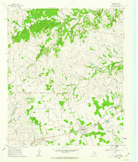
1960 · Tolar
USGS Topo · 1:24,000

1961 · Johnsville
USGS Topo · 1:24,000