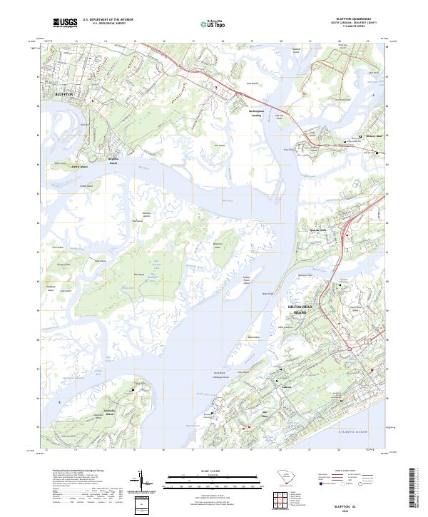
2024 Map of Bluffton
USGS Topo · Published 2024About this map
Bluffton and the surrounding Sea Islands appear here in a period of significant coastal development and conservation. The map highlights the sprawling Pinckney Island National Wildlife Refuge, which preserves the salt marshes and maritime forests between Mackay Creek and Skull Creek. Modern infrastructure, including the Cross Island Pkwy and William Hilton Pkwy, connects the historic mainland to the resort communities of Hilton Head Island, such as Sea Pines and Lawton.
Find a feature on this map
104 named features on this map. Tap any name to fly to it.
Don’t see what you’re looking for? This feature index may not catch every label — zoom into the map to look around manually.
Map Details
Editions of this 2024 Bluffton Map
This is the sole edition of this map. No revisions or reprints were ever made.
Other maps of this area

1920 · Okatie
USGS Topo · 1:62,500

1920 · Hilton Head
USGS Topo · 1:62,500

1920 · Bluffton
USGS Topo · 1:62,500

1942 · Okatie
USGS Topo · 1:62,500

1944 · Fort Fremont
USGS Topo · 1:62,500

1945 · Bluffton
USGS Topo · 1:62,500

1945 · Hilton Head
USGS Topo · 1:62,500

1947 · Savannah
USGS Topo · 1:250,000

1948 · Savannah
USGS Topo · 1:250,000
1955 · Pritchardville
USGS Topo · 1:24,000