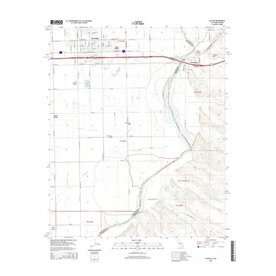
2015 Map of Blythe
USGS Topo · Published 2015About this map
Blythe and the agricultural expanse of the Palo Verde Valley define this landscape along the border of California and Arizona. The map illustrates a highly managed desert environment where the Colorado River serves as the lifeblood for a massive irrigation network including the C Canal, Lovekin Drain, and E Side Drain. This complex system of canals and drains supports the productive lands of Miller Farms and surrounding fields, contrasting sharply with the arid terrain of the Great Colorado Valley to the east.
Find a feature on this map
91 named features on this map. Tap any name to fly to it.
Don’t see what you’re looking for? This feature index may not catch every label — zoom into the map to look around manually.
Map Details
Editions of this 2015 Blythe Map
This is the sole edition of this map. No revisions or reprints were ever made.
Other maps of this area

1933 · Cunningham Mtn
USGS Topo · 1:48,000

1934 · Trigo Peaks
USGS Topo · 1:48,000

1939 · Trigo Peaks
USGS Topo · 1:62,500

1940 · Dome Rock Mts
USGS Topo · 1:62,500

1942 · Blythe
USGS Topo · 1:250,000

1945 · Cibola
USGS Topo · 1:62,500

1951 · Blythe
USGS Topo · 1:24,000

1951 · McCoy Wash
USGS Topo · 1:24,000

1951 · Blythe NE
USGS Topo · 1:24,000

1951 · Cibola
USGS Topo · 1:62,500