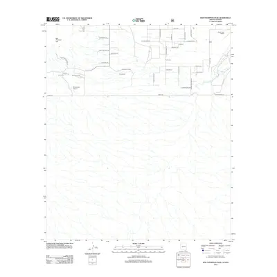
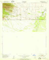
2012 Map of Bob Thompson Peak
USGS Topo · Published 2012About this map
Bob Thompson Peak anchors this corner of the Arizona-Sonora borderlands, where the high desert terrain transitions into the riparian corridor of the San Pedro River. The landscape is defined by established cattle operations and rural homesteads, including Montezuma Ranch, Zalesk Ranch, and Brown Ranch. In the north, Montezuma Canyon cuts through the elevation, while the plains are marked by a grid of local ranch roads like S Kings Ranch Rd and S Samuel Rd. Human impact on the land is further evidenced by Evelyn Field Airport near the northeastern boundary. Along the southern edge, Border Rd and S Border Monument Rd trace the international boundary, highlighting the remote yet structured nature of this border region during the early 21st century. The map provides a clear look at how water, elevation, and property lines dictate the layout of this high-altitude environment.
Find a feature on this map
35 named features on this map. Tap any name to fly to it.
Don’t see what you’re looking for? This feature index may not catch every label — zoom into the map to look around manually.
Map Details
Editions of this 2012 Bob Thompson Peak Map
This is the sole edition of this map. No revisions or reprints were ever made.
Other maps of this area

1914 · Hereford
USGS Topo · 1:125,000

1922 · Sunnyside
USGS Topo · 1:62,500

1932 · Stark
USGS Topo · 1:62,500

1938 · Sunnyside
USGS Topo · 1:62,500

1948 · Miller Peak
USGS Topo · 1:24,000

1948 · Sunnyside SE
USGS Topo · 1:24,000
1948 · Sunnyside
USGS Topo · 1:62,500
1952 · Hereford
USGS Topo · 1:24,000
1952 · Nicksville
USGS Topo · 1:24,000
1952 · Hereford SW
USGS Topo · 1:24,000