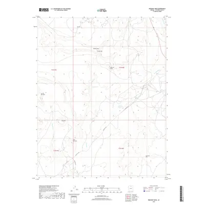
2018 Map of Bodaway Mesa
USGS Topo · Published 2018About this map
Bodaway Mesa and the surrounding high desert of Coconino County are defined by a complex network of seasonal drainages and prominent geological elevations. The topography is dominated by several named peaks including the Yon Dot Mountains, Sheep Mtn, and High Point Mtn, which provide critical vantage points across the landscape. The passage through Tolchaco Gap serves as a natural corridor between the mesa and the neighboring Billy Goat Knolls.
Find a feature on this map
21 named features on this map. Tap any name to fly to it.
Don’t see what you’re looking for? This feature index may not catch every label — zoom into the map to look around manually.
Map Details
Editions of this 2018 Bodaway Mesa Map
This is the sole edition of this map. No revisions or reprints were ever made.
Other maps of this area

1886 · Echo Cliffs
USGS Topo · 1:250,000

1891 · Echo Cliffs
USGS Topo · 1:250,000

1954 · Shinumo Altar NE
USGS Topo · 1:24,000

1954 · Shinumo Altar SE
USGS Topo · 1:24,000

1954 · Shinumo Altar
USGS Topo · 1:62,500

1955 · Blue Spring NE
USGS Topo · 1:24,000

1955 · Moa Ave NW
USGS Topo · 1:24,000

1955 · Blue Spring
USGS Topo · 1:62,500

1956 · Marble Canyon
USGS Topo · 1:250,000
1957 · The Gap SW
USGS Topo · 1:24,000