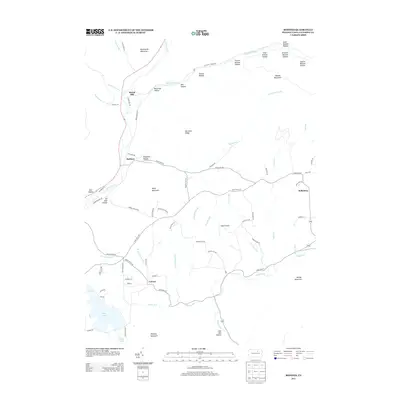
2013 Map of Bodines
USGS Topo · Published 2013About this map
Lycoming Cr carves a deep path through the highlands of northern Pennsylvania, anchoring a landscape defined by narrow hollows and high ridges like Burnetts Ridge. The settlement of Bodines sits at a strategic bend in the creek, while other small communities such as Marsh Hill and Calvert are tucked into the valleys created by Mill Hollow Run and Pleasant Stream. This geography dictated a development pattern of isolated mountain farmsteads and small crossroad hamlets connected by winding valley roads.
Find a feature on this map
81 named features on this map. Tap any name to fly to it.
Don’t see what you’re looking for? This feature index may not catch every label — zoom into the map to look around manually.
Map Details
Editions of this 2013 Bodines Map
This is the sole edition of this map. No revisions or reprints were ever made.
Other maps of this area

1921 · Trout Run
USGS Topo · 1:62,500

1923 · Trout Run
USGS Topo · 1:62,500

1925 · Blossburg
USGS Topo · 1:62,500

1927 · Blossburg
USGS Topo · 1:62,500

1930 · Warrensville
USGS Topo · 1:62,500

1934 · Warrensville
USGS Topo · 1:62,500

1942 · Canton
USGS Topo · 1:62,500

1944 · Blossburg
USGS Topo · 1:62,500

1944 · Trout Run
USGS Topo · 1:62,500

1944 · Canton
USGS Topo · 1:62,500
Featured Places
- Lewis Township, PA
- Calvert, Gamble Township
- Cascade Township, PA
- McIntyre Township, PA
- Gamble Township, PA