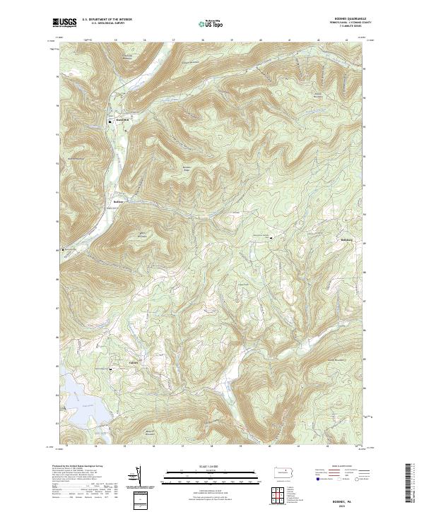
2023 Map of Bodines
USGS Topo · Published 2023About this map
Lycoming Creek carves a deep valley through this corner of the Allegheny Plateau, where the small settlements of Bodines and Marsh Hill have long served as local anchors. The landscape is defined by a dense network of hollows and ridges, including Burnetts Ridge and Sullivan Mountain, with drainage from Pleasant Stream and Slacks Run feeding the main creek. For those researching local family history, several small burial grounds are documented, such as Apker Cem and Pennsdale Cem near the northern valley, and Beech Valley Cem further south toward Calvert. The high ground reveals a mix of forested terrain and isolated clearings like Logue Field, while the eastern portion of the map shows the winding route of Wallis Run RD connecting Kellyburg to the neighboring valleys. This modern data illustrates how traditional rural footprints persist within the steep topography of the Pennsylvania wilds.
Find a feature on this map
93 named features on this map. Tap any name to fly to it.
Don’t see what you’re looking for? This feature index may not catch every label — zoom into the map to look around manually.
Map Details
Editions of this 2023 Bodines Map
This is the sole edition of this map. No revisions or reprints were ever made.
Other maps of this area

1921 · Trout Run
USGS Topo · 1:62,500

1923 · Trout Run
USGS Topo · 1:62,500

1925 · Blossburg
USGS Topo · 1:62,500

1927 · Blossburg
USGS Topo · 1:62,500

1930 · Warrensville
USGS Topo · 1:62,500

1934 · Warrensville
USGS Topo · 1:62,500

1942 · Canton
USGS Topo · 1:62,500

1944 · Blossburg
USGS Topo · 1:62,500

1944 · Trout Run
USGS Topo · 1:62,500

1944 · Canton
USGS Topo · 1:62,500
Featured Places
- Lewis Township, PA
- Calvert, Gamble Township
- Kellyburg, Cascade Township
- Bodines, Lewis Township
- Marsh Hill, McIntyre Township