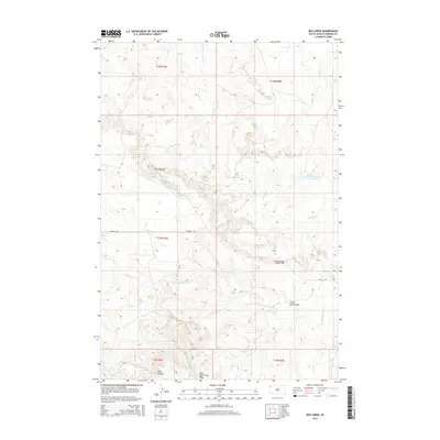
2015 Map of Bog Creek
USGS Topo · Published 2015About this map
The East Short Pine Hills rise dramatically in the southern portion of this Harding County landscape, providing a high-relief backdrop to a region defined by its complex drainage systems. Water management is central to the area's geography, evidenced by the presence of Matson Reservoir and Gilbert Number Two Reservoir. These water sources are vital in a terrain where the S Fork Grand River and the N Fork Moreau River carve through the plains, creating distinct geological features such as the escarpment known as The Jumpoff.
Find a feature on this map
19 named features on this map. Tap any name to fly to it.
Don’t see what you’re looking for? This feature index may not catch every label — zoom into the map to look around manually.
Map Details
Editions of this 2015 Bog Creek Map
This is the sole edition of this map. No revisions or reprints were ever made.
Other maps of this area

1935 · Harding
USGS Topo · 1:125,000

1935 · Buffalo
USGS Topo · 1:125,000

1954 · Lemmon
USGS Topo · 1:250,000

1957 · Lemmon
USGS Topo · 1:250,000

1971 · Buffalo
USGS Topo · 1:24,000

1971 · Saddle Butte
USGS Topo · 1:24,000

1973 · Bog Creek
USGS Topo · 1:24,000

1973 · Redig
USGS Topo · 1:24,000

1973 · Hells Canyon
USGS Topo · 1:24,000

1974 · Pine Spring
USGS Topo · 1:24,000