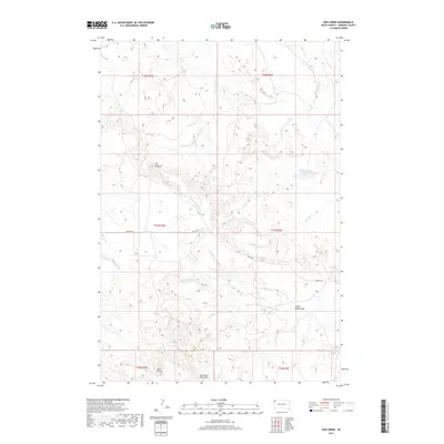
2017 Map of Bog Creek
USGS Topo · Published 2017About this map
East Short Pine Hills dominates the southern reaches of this corner of Harding County, marking a stark elevation change in the northwestern South Dakota prairie. The landscape is defined by the continental divide between two major river systems, with the S Fork Grand River flowing through the northern half and the N Fork Moreau River cutting across the south. This transition is most dramatically visible at The Jumpoff, a significant escarpment where the high plateau drops away into the drainage basins below.
Find a feature on this map
18 named features on this map. Tap any name to fly to it.
Don’t see what you’re looking for? This feature index may not catch every label — zoom into the map to look around manually.
Map Details
Editions of this 2017 Bog Creek Map
This is the sole edition of this map. No revisions or reprints were ever made.
Other maps of this area

1935 · Harding
USGS Topo · 1:125,000

1935 · Buffalo
USGS Topo · 1:125,000

1954 · Lemmon
USGS Topo · 1:250,000

1957 · Lemmon
USGS Topo · 1:250,000

1971 · Buffalo
USGS Topo · 1:24,000

1971 · Saddle Butte
USGS Topo · 1:24,000

1973 · Bog Creek
USGS Topo · 1:24,000

1973 · Redig
USGS Topo · 1:24,000

1973 · Hells Canyon
USGS Topo · 1:24,000

1974 · Pine Spring
USGS Topo · 1:24,000