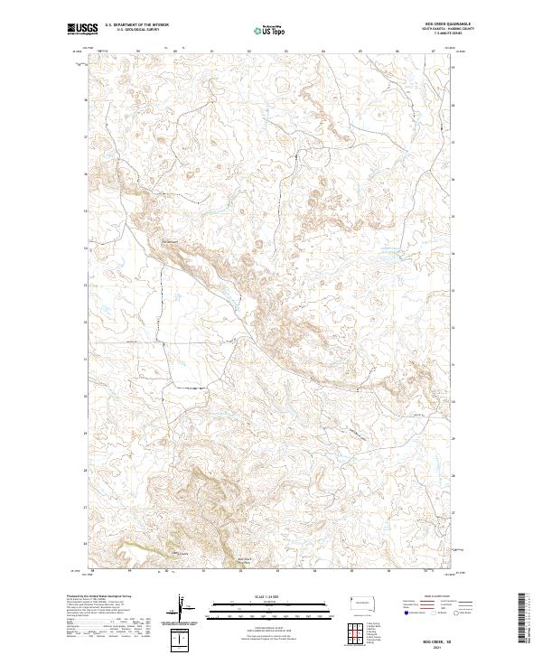
2021 Map of Bog Creek
USGS Topo · Published 2021About this map
The Jumpoff dominates the central landscape of this Harding County region, where the high plains break away into a complex network of drainages and buttes. This modern survey illustrates a watershed divide of the northern plains, showing the headwaters and tributaries of two major river systems. To the north, the S Fork Grand River and its feeders like Faulkner Cr and Bog Cr carve through the terrain, while the southern portion of the map is defined by the N Fork Moreau River and the East Short Pine Hills. Human impact is sparse, centered on managed water resources like the Gilbert Number Two Reservoir and the transit corridor of Mackey Rd. The topography reveals the intricate erosion patterns of Chalk Butte Draw and the Sand Coulee, providing a clear picture of the arid, wind-swept geography of South Dakota's northwest corner.
Find a feature on this map
18 named features on this map. Tap any name to fly to it.
Don’t see what you’re looking for? This feature index may not catch every label — zoom into the map to look around manually.
Map Details
Editions of this 2021 Bog Creek Map
This is the sole edition of this map. No revisions or reprints were ever made.
Other maps of this area

1935 · Harding
USGS Topo · 1:125,000

1935 · Buffalo
USGS Topo · 1:125,000

1954 · Lemmon
USGS Topo · 1:250,000

1957 · Lemmon
USGS Topo · 1:250,000

1971 · Buffalo
USGS Topo · 1:24,000

1971 · Saddle Butte
USGS Topo · 1:24,000

1973 · Bog Creek
USGS Topo · 1:24,000

1973 · Redig
USGS Topo · 1:24,000

1973 · Hells Canyon
USGS Topo · 1:24,000

1974 · Pine Spring
USGS Topo · 1:24,000