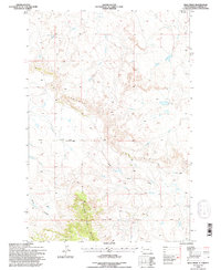
1993 Map of Bog Creek
USGS Topo · Published 1995About this map
East Short Pine Hills dominates the southern landscape of this 1990s Harding County survey, where the Custer National Forest encompasses a dramatic terrain of breaks and drainages. The map captures a pivotal watershed divide between the South Fork Grand River to the north and the North Fork Moreau River to the south. Distinctive geological features like The Jumpoff and Chalk Butte Draw define the topography, illustrating the erosion patterns characteristic of the northern plains. Settlement is sparse, represented by rural infrastructure such as Mackey Road and a solitary landing strip near the headwaters of Faulkner Creek. The drainage network, including Bog Creek and Buffalo Creek, reveals how water sources dictated the layout of regional ranching and forest land long before modern development altered the South Dakota interior.
Find a feature on this map
18 named features on this map. Tap any name to fly to it.
Don’t see what you’re looking for? This feature index may not catch every label — zoom into the map to look around manually.
Map Details
Editions of this 1993 Bog Creek Map
This is the sole edition of this map. No revisions or reprints were ever made.
Other maps of this area

1935 · Harding
USGS Topo · 1:125,000

1935 · Buffalo
USGS Topo · 1:125,000

1954 · Lemmon
USGS Topo · 1:250,000

1957 · Lemmon
USGS Topo · 1:250,000

1971 · Buffalo
USGS Topo · 1:24,000

1971 · Saddle Butte
USGS Topo · 1:24,000

1973 · Bog Creek
USGS Topo · 1:24,000

1973 · Redig
USGS Topo · 1:24,000

1973 · Hells Canyon
USGS Topo · 1:24,000

1974 · Pine Spring
USGS Topo · 1:24,000