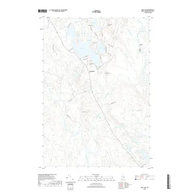
2018 Map of Bog Lake
USGS Topo · Published 2018About this map
Northfield serves as the central settlement in this inland Washington County landscape, where the Machias River and East Machias River define the local topography. The area is characterized by a dense network of water bodies and wetlands, including the expansive Bog Lake, Fulton Lake, and the marshy Pug-Heath. Numerous river features such as Bobsled Rips, Getchell Riffles, and Smith Mill Pitch indicate the historical importance of these waterways for navigation or industry. Significant elevations like Harmon Mtn and Andy Mtn overlook the low-lying lake basins, while roads like Diamond Match Rd and Smith Landing Rd point to the region's long-standing connection to the timber and matchwood industries. The map provides a look at the modern rural layout of these remote townships, preserving the names of localized landmarks like Crooked Pitch and Sumac Hill.
Find a feature on this map
57 named features on this map. Tap any name to fly to it.
Don’t see what you’re looking for? This feature index may not catch every label — zoom into the map to look around manually.
Map Details
Editions of this 2018 Bog Lake Map
This is the sole edition of this map. No revisions or reprints were ever made.
Other maps of this area

1918 · Machias
USGS Topo · 1:62,500

1921 · Columbia Falls
USGS Topo · 1:62,500

1921 · Columbia Falls
USGS Topo · 1:62,500

1941 · Columbia Falls
USGS Topo · 1:62,500

1941 · Machias
USGS Topo · 1:62,500

1941 · Wesley
USGS Topo · 1:62,500

1941 · Gardner Lake
USGS Topo · 1:62,500

1942 · Columbia Falls
USGS Topo · 1:62,500

1943 · Wesley
USGS Topo · 1:62,500

1943 · Gardner Lake
USGS Topo · 1:62,500