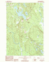
1990 Map of Bog Lake
USGS Topo · Published 1990About this map
Northfield serves as the primary settlement hub in this interior Washington County landscape, surrounded by an intricate network of glacial lakes and river systems. The Machias River winds through the western half of the quadrangle, characterized by technical water features such as Bobsled Rips and Great Falls, while the East Machias River defines the northeastern boundary with its own series of riffles and pitches. To the north, Bog Lake dominates the terrain, flanked by the unique Pug Heath and the prominent Carry Ridge.
Find a feature on this map
52 named features on this map. Tap any name to fly to it.
Don’t see what you’re looking for? This feature index may not catch every label — zoom into the map to look around manually.
Map Details
Editions of this 1990 Bog Lake Map
This is the sole edition of this map. No revisions or reprints were ever made.
Other maps of this area

1918 · Machias
USGS Topo · 1:62,500

1921 · Columbia Falls
USGS Topo · 1:62,500

1921 · Columbia Falls
USGS Topo · 1:62,500

1941 · Columbia Falls
USGS Topo · 1:62,500

1941 · Machias
USGS Topo · 1:62,500

1941 · Wesley
USGS Topo · 1:62,500

1941 · Gardner Lake
USGS Topo · 1:62,500

1942 · Columbia Falls
USGS Topo · 1:62,500

1943 · Wesley
USGS Topo · 1:62,500

1943 · Gardner Lake
USGS Topo · 1:62,500