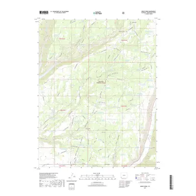
2019 Map of Boggy Draw
USGS Topo · Published 2019About this map
San Juan National Forest defines this high-elevation landscape in Montezuma County, where a complex network of forest roads and water management features tells the story of Colorado's public lands. The map reveals an intensive system of namesake water storage, including the Railroad Reservoir, Sawmill Reservoir, and Phoneline Reservoir, alongside the historic Morgan Cabin Reservoir. These features, many named for early utilitarian purposes, suggest the area's history of logging, ranching, and the infrastructure required to sustain such activities in the dry interior West.
Find a feature on this map
78 named features on this map. Tap any name to fly to it.
Don’t see what you’re looking for? This feature index may not catch every label — zoom into the map to look around manually.
Map Details
Editions of this 2019 Boggy Draw Map
This is the sole edition of this map. No revisions or reprints were ever made.
Other maps of this area

1956 · Cortez
USGS Topo · 1:250,000

1958 · Cortez
USGS Topo · 1:250,000

1959 · Cortez
USGS Topo · 1:250,000

1962 · Cortez
USGS Topo · 1:250,000

1963 · Stoner
USGS Topo · 1:24,000
1963 · Nipple Mountain
USGS Topo · 1:24,000

1965 · Willow Spring
USGS Topo · 1:24,000

1965 · Dolores East
USGS Topo · 1:24,000

1965 · Dolores West
USGS Topo · 1:24,000
1965 · Millwood
USGS Topo · 1:24,000