
1965 Map of Dolores East
USGS Topo · Published 1967About this map
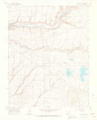
The Dolores River valley and its surrounding highlands appear here in the mid-1960s, a landscape defined by complex irrigation and the remnants of earlier transit routes. Just east of the town of Dolores, the map traces the Old Railroad Grade as it winds through Lost Canyon Creek, marking the path of the Rio Grande Southern Railroad's former presence in the San Juan mountains. The high plateau of Haycamp Mesa separates the river valley from a sophisticated network of reservoirs and canals to the south.
Find a feature on this map
34 named features on this map. Tap any name to fly to it.
Don’t see what you’re looking for? This feature index may not catch every label — zoom into the map to look around manually.
Map Details
Editions of this 1965 Dolores East Map
2 editions found
Other maps of this area

1956 · Cortez
USGS Topo · 1:250,000

1958 · Cortez
USGS Topo · 1:250,000

1959 · Cortez
USGS Topo · 1:250,000

1962 · Cortez
USGS Topo · 1:250,000

1963 · Stoner
USGS Topo · 1:24,000

1965 · Cortez
USGS Topo · 1:24,000

1965 · Dolores West
USGS Topo · 1:24,000
1965 · Millwood
USGS Topo · 1:24,000
1965 · Mancos
USGS Topo · 1:24,000
1965 · Point Lookout
USGS Topo · 1:24,000