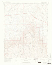
1965 Map of Point Lookout
USGS Topo · Published 1968About this map
Mesa Verde National Park and the surrounding high desert topography dominate this mid-1960s survey, illustrating the complex intersection of prehistoric sites and modern park infrastructure. The map details an extensive network of Indian Ruins scattered across the North Rim, Moccasin Mesa, and Chapin Mesa, highlighting the density of archaeological features in this region.
Find a feature on this map
42 named features on this map. Tap any name to fly to it.
Don’t see what you’re looking for? This feature index may not catch every label — zoom into the map to look around manually.
Map Details
Editions of this 1965 Point Lookout Map
3 editions found
Other maps of this area

1912 · Soda Canyon
USGS Topo · 1:62,500

1915 · Soda Canyon
USGS Topo · 1:62,500

1956 · Cortez
USGS Topo · 1:250,000

1958 · Cortez
USGS Topo · 1:250,000

1959 · Cortez
USGS Topo · 1:250,000

1962 · Cortez
USGS Topo · 1:250,000

1965 · Cortez
USGS Topo · 1:24,000

1965 · Dolores East
USGS Topo · 1:24,000

1965 · Dolores West
USGS Topo · 1:24,000
1965 · Millwood
USGS Topo · 1:24,000