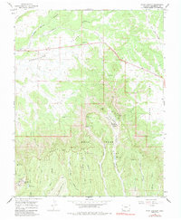
1965 Map of Point Lookout
USGS Topo · Published 1984About this map
Mesa Verde National Park dominates this mid-1960s landscape, illustrating the intersection of ancient geography and modern park infrastructure. The map details the transition from the Montezuma Valley to the elevated heights of the North Rim, where landmarks like Point Lookout and The Knife Edge rise above the surrounding terrain. This era of the park's development is marked by established visitor facilities at Morefield Village and Far View Annex, alongside specialized structures such as the Amphitheater and Ranger Station.
Find a feature on this map
51 named features on this map. Tap any name to fly to it.
Don’t see what you’re looking for? This feature index may not catch every label — zoom into the map to look around manually.
Map Details
Editions of this 1965 Point Lookout Map
3 editions found
Other maps of this area

1912 · Soda Canyon
USGS Topo · 1:62,500

1915 · Soda Canyon
USGS Topo · 1:62,500

1956 · Cortez
USGS Topo · 1:250,000

1958 · Cortez
USGS Topo · 1:250,000

1959 · Cortez
USGS Topo · 1:250,000

1962 · Cortez
USGS Topo · 1:250,000

1965 · Cortez
USGS Topo · 1:24,000

1965 · Dolores East
USGS Topo · 1:24,000

1965 · Dolores West
USGS Topo · 1:24,000
1965 · Millwood
USGS Topo · 1:24,000