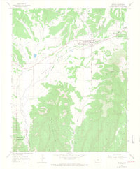
1965 Map of Mancos
USGS Topo · Published 1968About this map
Mancos sits at the heart of the Mancos Valley, serving as a hub for the surrounding high-desert and mountainous terrain during the mid-1960s. The landscape is defined by the convergence of the West Mancos River, East Mancos River, and Chicken Creek, which feed into the main Mancos River as it flows southwest toward Mesa Verde National Park. This survey documents a critical period of infrastructure, showing an aqueduct and pipeline system alongside an old railroad grade, illustrating how the town's connection to water and transport shaped its development.
Find a feature on this map
28 named features on this map. Tap any name to fly to it.
Don’t see what you’re looking for? This feature index may not catch every label — zoom into the map to look around manually.
Map Details
Editions of this 1965 Mancos Map
3 editions found
Other maps of this area

1895 · La Plata
USGS Topo · 1:62,500

1897 · La Plata
USGS Topo · 1:62,500

1899 · La Plata
USGS Topo · 1:62,500

1908 · La Plata
USGS Topo · 1:62,500

1912 · Soda Canyon
USGS Topo · 1:62,500

1913 · Red Mesa
USGS Topo · 1:62,500

1915 · Soda Canyon
USGS Topo · 1:62,500

1956 · Cortez
USGS Topo · 1:250,000

1958 · Cortez
USGS Topo · 1:250,000

1959 · Cortez
USGS Topo · 1:250,000