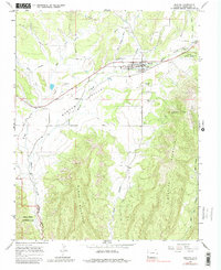
1965 Map of Mancos
USGS Topo · Published 1983About this map
Mancos sits at the northern end of the fertile Mancos Valley, serving as a vital agricultural and transit hub in the mid-1960s. The landscape is defined by the sharp transition from the valley floor to the towering heights of Menefee Mountain and Weber Mountain. Local history is deeply etched into the terrain, visible in the Old Railroad Grade and an aqueduct that highlights the complex water management required in this high-altitude environment. Cultural landmarks such as the Cedar Grove Cemetery and Weber Cem provide touchpoints for genealogical research. To the south, the map reaches into the rugged northern boundary of Mesa Verde National Park, where the Mancos River Canyon and Weber Canyon carve deep paths through the plateau, showcasing the dramatic geology of the Four Corners region.
Find a feature on this map
26 named features on this map. Tap any name to fly to it.
Don’t see what you’re looking for? This feature index may not catch every label — zoom into the map to look around manually.
Map Details
Editions of this 1965 Mancos Map
3 editions found
Other maps of this area

1895 · La Plata
USGS Topo · 1:62,500

1897 · La Plata
USGS Topo · 1:62,500

1899 · La Plata
USGS Topo · 1:62,500

1908 · La Plata
USGS Topo · 1:62,500

1912 · Soda Canyon
USGS Topo · 1:62,500

1913 · Red Mesa
USGS Topo · 1:62,500

1915 · Soda Canyon
USGS Topo · 1:62,500

1956 · Cortez
USGS Topo · 1:250,000

1958 · Cortez
USGS Topo · 1:250,000

1959 · Cortez
USGS Topo · 1:250,000