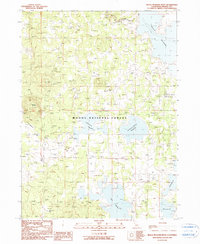
1990 Map of Boles Meadow West
USGS Topo · Published 1990About this map
Modoc National Forest encompasses most of this terrain, characterized by a complex network of seasonal water sources and specialized camps. The landscape is defined by its water management and grazing history, evidenced by Sallys Camp, Wildhorse Cow Camp, and the uniquely named Gas Drum Flat near the southern boundary. These labels suggest a history of seasonal ranching and forestry operations in a high-elevation environment where water is a precious resource.
Find a feature on this map
20 named features on this map. Tap any name to fly to it.
Don’t see what you’re looking for? This feature index may not catch every label — zoom into the map to look around manually.
Map Details
Editions of this 1990 Boles Meadow West Map
This is the sole edition of this map. No revisions or reprints were ever made.
Other maps of this area

1886 · Alturas
USGS Topo · 1:250,000

1886 · Modoc Lava Bed
USGS Topo · 1:250,000

1892 · Modoc Lava-Bed
USGS Topo · 1:250,000

1892 · Alturas
USGS Topo · 1:250,000

1951 · Clear Lake Reservoir
USGS Topo · 1:62,500

1952 · Hackamore
USGS Topo · 1:62,500

1954 · Alturas
USGS Topo · 1:250,000

1958 · Alturas
USGS Topo · 1:250,000

1962 · Alturas
USGS Topo · 1:250,000

1962 · Steele Swamp
USGS Topo · 1:62,500