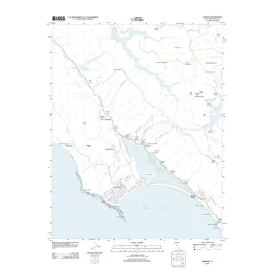
2012 Map of Bolinas
USGS Topo · Published 2012About this map
Bolinas Lagoon dominates the coastline of this Marin County survey, serving as a focal point for the surrounding coastal communities. The residential grids of Stinson Beach and Bolinas Mesa are clearly defined, separated by the narrow inlet and Kent Island. To the north, the terrain rises into the Golden Gate National Rec Area, where several reservoirs including Kent Lake and Alpine Lake manage the region's water resources.
Find a feature on this map
103 named features on this map. Tap any name to fly to it.
Don’t see what you’re looking for? This feature index may not catch every label — zoom into the map to look around manually.
Map Details
Editions of this 2012 Bolinas Map
This is the sole edition of this map. No revisions or reprints were ever made.
Other maps of this area

1897 · Tamalpais
USGS Topo · 1:62,500

1914 · Petaluma
USGS Topo · 1:62,500

1916 · Point Reyes
USGS Topo · 1:48,000

1918 · Point Reyes
USGS Topo · 1:62,500

1941 · Tamalpais
USGS Topo · 1:62,500

1942 · Petaluma
USGS Topo · 1:62,500

1947 · Santa Rosa
USGS Topo · 1:250,000

1947 · San Francisco
USGS Topo · 1:250,000

1948 · San Francisco
USGS Topo · 1:250,000

1949 · Santa Rosa
USGS Topo · 1:250,000