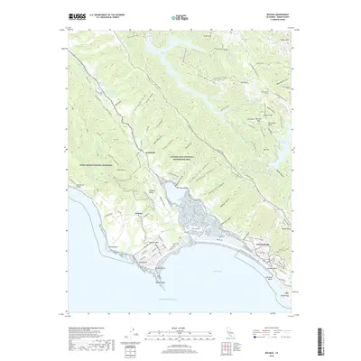
2018 Map of Bolinas
USGS Topo · Published 2018About this map
Stinson Beach and the residential streets of Bolinas Mesa anchor this coastal survey, where the Pacific tide meets the sprawling wetlands of Bolinas Lagoon. The landscape is defined by the prominent Bolinas Ridge, which separates the coastal settlements from the interior drainages of Kent Lake and Alpine Lake. A sophisticated network of trails and fire roads, such as the Dipsea Trail and Willow Camp Fire Road, crisscross the ridges, reflecting the area's transition into a major conservation and recreation zone.
Find a feature on this map
110 named features on this map. Tap any name to fly to it.
Don’t see what you’re looking for? This feature index may not catch every label — zoom into the map to look around manually.
Map Details
Editions of this 2018 Bolinas Map
This is the sole edition of this map. No revisions or reprints were ever made.
Other maps of this area

1897 · Tamalpais
USGS Topo · 1:62,500

1914 · Petaluma
USGS Topo · 1:62,500

1916 · Point Reyes
USGS Topo · 1:48,000

1918 · Point Reyes
USGS Topo · 1:62,500

1941 · Tamalpais
USGS Topo · 1:62,500

1942 · Petaluma
USGS Topo · 1:62,500

1947 · Santa Rosa
USGS Topo · 1:250,000

1947 · San Francisco
USGS Topo · 1:250,000

1948 · San Francisco
USGS Topo · 1:250,000

1949 · Santa Rosa
USGS Topo · 1:250,000