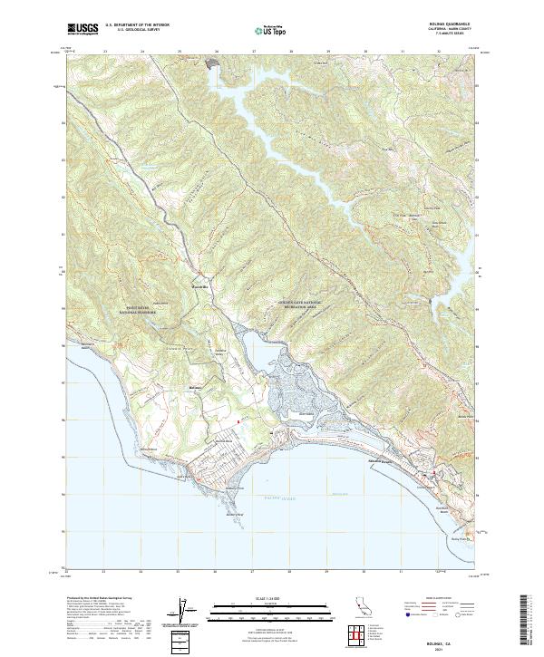
2021 Map of Bolinas
USGS Topo · Published 2021About this map
Stinson Beach and the coastal village of Bolinas anchor this study of the Marin County coastline, where the land meets the Pacific Ocean at Bolinas Bay. The geography is defined by the narrow Bolinas Lagoon, separating the residential streets of Bolinas Mesa from the long, thin spit of Seadrift Road. Inland, the terrain rises sharply into the Bolinas Ridge, a landscape of deeply incised drainages including Copper Mine Gulch, Morses Gulch, and Volunteer Canyon.
Find a feature on this map
112 named features on this map. Tap any name to fly to it.
Don’t see what you’re looking for? This feature index may not catch every label — zoom into the map to look around manually.
Map Details
Editions of this 2021 Bolinas Map
This is the sole edition of this map. No revisions or reprints were ever made.
Other maps of this area

1897 · Tamalpais
USGS Topo · 1:62,500

1914 · Petaluma
USGS Topo · 1:62,500

1916 · Point Reyes
USGS Topo · 1:48,000

1918 · Point Reyes
USGS Topo · 1:62,500

1941 · Tamalpais
USGS Topo · 1:62,500

1942 · Petaluma
USGS Topo · 1:62,500

1947 · Santa Rosa
USGS Topo · 1:250,000

1947 · San Francisco
USGS Topo · 1:250,000

1948 · San Francisco
USGS Topo · 1:250,000

1949 · Santa Rosa
USGS Topo · 1:250,000