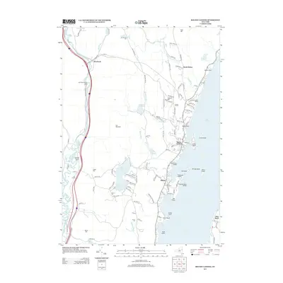
2013 Map of Bolton Landing
USGS Topo · Published 2013About this map
The western shores of Lake George define this landscape, where the settlements of Bolton Landing and Bolton serve as primary hubs for the region. The topography rises sharply from the water's edge toward inland peaks like Cat Mountain and Federal Hill, creating a corridor of residential and resort development concentrated along the shoreline. Further west, the Schroon River meanders through the valley near the hamlet of Riverbank, providing a distinct hydrological contrast to the deep waters of the main lake.
Find a feature on this map
115 named features on this map. Tap any name to fly to it.
Don’t see what you’re looking for? This feature index may not catch every label — zoom into the map to look around manually.
Map Details
Editions of this 2013 Bolton Landing Map
This is the sole edition of this map. No revisions or reprints were ever made.
Other maps of this area

1895 · North Creek
USGS Topo · 1:62,500

1895 · Glens Falls
USGS Topo · 1:62,500

1897 · Bolton
USGS Topo · 1:62,500

1897 · Glens Falls
USGS Topo · 1:62,500

1897 · North Creek
USGS Topo · 1:62,500

1900 · Bolton
USGS Topo · 1:62,500

1903 · Luzerne
USGS Topo · 1:62,500

1938 · Glens Falls
USGS Topo · 1:62,500

1947 · Glens Falls
USGS Topo · 1:62,500

1950 · Glens Falls
USGS Topo · 1:250,000