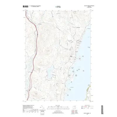
2019 Map of Bolton Landing
USGS Topo · Published 2019About this map
Bolton Landing serves as the focal point for this survey along the western shores of Lake George. The landscape transition from the established lakefront at Huddle Bay and Basin Bay to the interior highlands reveals a dense network of family and community history. Genealogists will find numerous smaller burial grounds including Herrick Cem, Beswick Cem, and the Lamb Hill Cem situated near the heights of Lamb Hill. To the west, the Schroon River creates a natural corridor for the settlement at Riverbank, while the high peaks of Cat Mtn and Dixon Hill define the interior terrain. The map documents the intricate shoreline and its various islands, such as Dome Island and Green Island, alongside the development of upland communities like North Bolton and Federal Hill.
Find a feature on this map
108 named features on this map. Tap any name to fly to it.
Don’t see what you’re looking for? This feature index may not catch every label — zoom into the map to look around manually.
Map Details
Editions of this 2019 Bolton Landing Map
This is the sole edition of this map. No revisions or reprints were ever made.
Other maps of this area

1895 · North Creek
USGS Topo · 1:62,500

1895 · Glens Falls
USGS Topo · 1:62,500

1897 · Bolton
USGS Topo · 1:62,500

1897 · Glens Falls
USGS Topo · 1:62,500

1897 · North Creek
USGS Topo · 1:62,500

1900 · Bolton
USGS Topo · 1:62,500

1903 · Luzerne
USGS Topo · 1:62,500

1938 · Glens Falls
USGS Topo · 1:62,500

1947 · Glens Falls
USGS Topo · 1:62,500

1950 · Glens Falls
USGS Topo · 1:250,000