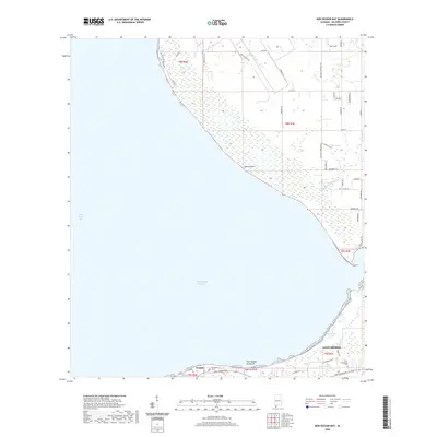
2020 Map of Bon Secour Bay
USGS Topo · Published 2020About this map
Fort Morgan Peninsula dominates the southern reach of this coastal landscape, separating the wide expanse of Bon Secour Bay from the Gulf of Mexico. This modern survey reflects the complex wetlands and bayous that define the region's geography, including Skunk Bayou, Sand Bayou, and Long Bayou. The settlement of Gasque is positioned along the narrow strip of land where Dixie Graves Pkwy provides the primary transit route east toward Gulf Shores.
Find a feature on this map
51 named features on this map. Tap any name to fly to it.
Don’t see what you’re looking for? This feature index may not catch every label — zoom into the map to look around manually.
Map Details
Editions of this 2020 Bon Secour Bay Map
This is the sole edition of this map. No revisions or reprints were ever made.
Other maps of this area

1921 · Bon Secour
USGS Topo · 1:62,500

1921 · Point Clear
USGS Topo · 1:62,500

1941 · Foley
USGS Topo · 1:62,500

1941 · Weeks Bay
USGS Topo · 1:62,500

1943 · Weeks Bay
USGS Topo · 1:62,500

1943 · Foley
USGS Topo · 1:62,500
1956 · Point Clear
USGS Topo · 1:24,000

1957 · Pensacola
USGS Topo · 1:250,000

1959 · Pensacola
USGS Topo · 1:250,000

1960 · Pensacola
USGS Topo · 1:250,000