Old Maps of Gulf Shores, Alabama
Explore 45 old maps of Gulf Shores, spanning from 1921 to today. These high-resolution historic maps reveal how streets, neighborhoods, landmarks, and natural features evolved over time — perfect for genealogy, metal detecting, research, and local history exploration.
What you can do with these maps:
- See how Gulf Shores changed over time: Compare historical maps to modern-day views to trace roads, homesites, rail lines & more.
- View detailed metadata: Each map includes creators, publishers, year, scale, and archive source.
- Overlay maps with satellite & LiDAR: Visualize the past alongside modern tools to explore terrain & human change.
- Trusted historical sources: Maps sourced from the USGS, Library of Congress, and other archives.
- Access maps your way: View online, download high-res files, or order prints for personal or research use.
Start exploring old maps of Gulf Shores to uncover forgotten places, hidden landmarks, and the deep history beneath your feet.
Gulf Shores, AL maps
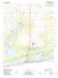
(45)- 1921 Map of Bon Secour
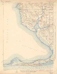
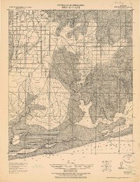 1921 Bon Secour1921 Print · USGSThe Alabama coast is captured here in the early twentieth century, showing a landscape of rail-connected towns and untouched shorelines. Researchers can trace early infrastructure like the Ft. Morgan and Summerdale RR and find quiet coastal outposts like Josephine P.O. and Bon Secour.2 unique versions available
 - 1921 Map of Point Clear
 1921 Point Clear1921 Print · USGSThe eastern shore of Mobile Bay and its tidal inlets are captured here in the years following the Great War. Researchers can trace early coastal settlements like Point Clear, find family names at Seymours Bluff, and locate the historic Dixie Road corridor.2 unique versions available
 - 1941 Map of Foley, 1964 Print
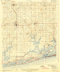
 1941 Foley1964 Print · USGSCoastal Baldwin County in the early 1940s shows the working landscape of the Gulf before the era of major development. Researchers can trace the Louisville and Nashville Railroad line, find local landmarks like Stone Quarry Bayou, and locate early community sites such as Miflin Sch.3 unique versions available
 - 1941 Map of Weeks Bay, 1965 Print
 1941 Weeks Bay1965 Print · USGSThe Alabama coast at the start of the 1940s reveals a world of bayous, river landings, and quiet maritime settlements. Trace family roots and local history through landmarks like Magnolia Springs, the Confederate Rest Cem, and Springhill Sch.2 unique versions available
 - 1943 Map of Weeks Bay
 1943 Weeks Bay1943 Print · USGSBaldwin County's shoreline and river systems are captured here in the early 1940s, just as the coastal landscape was modernizing. Genealogists can trace family names and local sites at Confederate Rest Cem, Magnolia Springs, and McKenzie Ferry.3 unique versions available
 - 1943 Map of Foley
 1943 Foley1943 Print · USGSCoastal Baldwin County in the early 1940s shows a landscape of rail-end farming hubs and quiet bayou settlements before the rise of modern tourism. Genealogists and historians can trace local family roots through sites like Summerdale Cem, the Little Rock School, and the fishing village of Bon Secour.2 unique versions available
 - 1944 Map of Miflin
 1944 Miflin1944 Print · USGSCoastal Alabama and the Florida borderlands are captured here during the mid-forties, showing the quiet maritime life of the Gulf shore. Researchers can trace family-named points and old settlements like Josephine, Perdido Beach, and the Josephine School.
 - 1957 Map of Pensacola, 1967 Print
 1957 Pensacola1967 Print · USGSThe Florida Panhandle and Alabama coast are seen here at the height of the Cold War, showcasing a unique mix of military aviation and emerging beach tourism. Genealogists and local historians can trace legacy sites like Old Corry Field, the lumber town of Bagdad, and the coastal reaches of Santa Rosa Island.3 unique versions available
 - 1959 Map of Pensacola
 1959 Pensacola1959 Print · USGSThe Florida Panhandle and Alabama coast come alive in this late fifties survey of military aviation and maritime life. Genealogists can trace family roots in Bagdad, Loxley, and Milton while mapping the rails of the Louisville and Nashville.
 - 1960 Map of Pensacola
 1960 Pensacola1960 Print · USGSThe Florida Panhandle and Alabama's eastern shore are shown during a period of rapid military and coastal growth. Genealogists and historians can trace the mid-century footprints of Warrington, the Pensacola NAS (Chevalier), and the Blackwater River timber lands.
 - 1978 Map of Pensacola, 1980 Print
 1978 Pensacola1980 Print · USGSThe Gulf Coast at the end of the 1970s reveals a landscape shaped by maritime industry and a heavy naval presence. Researchers can trace the development of Pensacola alongside quiet coastal hamlets like Magnolia Springs and the historic Fort Pickens State Park.3 unique versions available
 - 1980 Map of Orange Beach
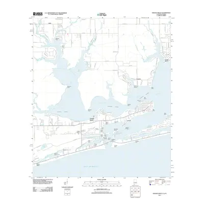
 1980 Orange Beach1980 Print · USGSCoastal Alabama was entering a new era of development in the late seventies, centered on the waterways of Baldwin County. Local historians can trace the early layouts of Orange Beach, the residential expansion on Ono Island, and landmarks like Lay Cem or the U S Naval Res Wolf Field.2 unique versions available
 - 1980 Map of Bon Secour Bay
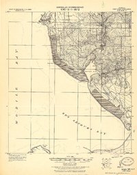
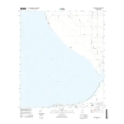
 1980 Bon Secour Bay1980 Print · USGSCoastal Baldwin County is captured here in the late seventies, showing the vital maritime corridor where the Intracoastal Waterway meets the bay. Genealogists and local historians can locate Gasque, Shellbank Ch, and Miller Memorial Cem along the southern shore.2 unique versions available
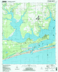
 - 1980 Map of Gulf Shores
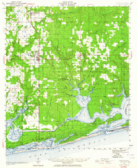
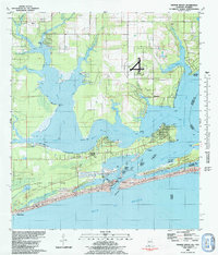
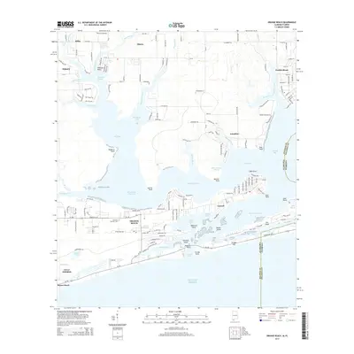
 1980 Gulf Shores1980 Print · USGSGulf Shores and the Baldwin County coast are captured here in 1980, showcasing a landscape of maritime industry and early tourism. Trace the development of the Intracoastal Waterway and locate local landmarks like Swift Sch and Jack Edwards Airport.2 unique versions available
 - 1980 Map of Pine Beach
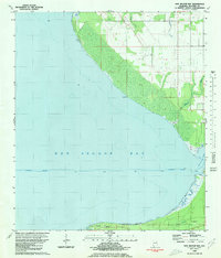
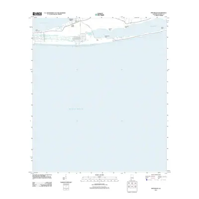
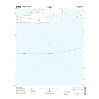
 1980 Pine Beach1980 Print · USGSThe Alabama coast is captured here in the early eighties, showing the thin barrier peninsula between Little Lagoon and the sea. Researchers can trace the early development of Gulf Shores and find local landmarks like Gator Lake and Edith Hammock.
 - 1994 Map of Orange Beach, 1998 Print
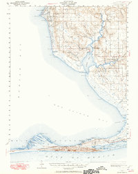
 1994 Orange Beach1998 Print · USGSThe Alabama coast in the mid-nineties shows the intricate meeting of bayou and beach before modern development peaked. Researchers can trace the legacy of coastal settlements like Josephine, locate the Lay Cem, and explore the 1994 layout of Gulf State Park.
 - 2011 Map of Bon Secour Bay, 2011 Print
 2011 Bon Secour Bay2011 Print · USGSCovers Gulf Shores, including Gasque, Baldwin County, and other nearby areas
 - 2011 Map of Gulf Shores, 2011 Print
 2011 Gulf Shores2011 Print · USGSCovers Gulf Shores, including Foley, Orange Beach, and other nearby areas
 - 2011 Map of Gulf Shores OE S, 2011 Print
 2011 Gulf Shores OE S2011 Print · USGSCovers Gulf Shores, including Baldwin County, United States, and other nearby areas
 - 2011 Map of Pine Beach, 2011 Print
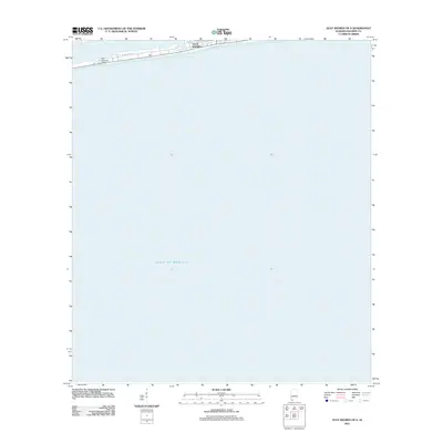
 2011 Pine Beach2011 Print · USGSCovers Gulf Shores, including Cedar Grove, Palmetto Beach, and other nearby areas
 - 2011 Map of Orange Beach, 2011 Print
 2011 Orange Beach2011 Print · USGSCovers Gulf Shores, including Foley, Orange Beach, and other nearby areas
 - 2014 Map of Bon Secour Bay, 2014 Print
 2014 Bon Secour Bay2014 Print · USGSCovers Gulf Shores, including Gasque, Baldwin County, and other nearby areas
 - 2014 Map of Orange Beach, 2014 Print
 2014 Orange Beach2014 Print · USGSCovers Gulf Shores, including Foley, Orange Beach, and other nearby areas
 - 2014 Map of Pine Beach, 2014 Print
 2014 Pine Beach2014 Print · USGSCovers Gulf Shores, including Cedar Grove, Palmetto Beach, and other nearby areas
 - 2014 Map of Gulf Shores OE S, 2014 Print
 2014 Gulf Shores OE S2014 Print · USGSCovers Gulf Shores, including Baldwin County, United States, and other nearby areas
Showing maps 1-25 of 45
Top cities near Gulf Shores
- Fairhope historical maps
- Foley historical maps
- Orange Beach historical maps
- Point Clear historical maps
- Elberta historical maps
- Bon Secour historical maps
See more
Top neighborhoods of Gulf Shores
Frequently asked questions
- What are the different types of historical maps available for Gulf Shores?
- What is the oldest map of Gulf Shores?
- Where can I purchase historical maps of Gulf Shores for my home or office?
- Where can I download high-res historical maps of Gulf Shores?
- Are there historical topographic maps available for Gulf Shores?
- Is there historical aerial imagery available for Gulf Shores?
- Where are historical maps of Gulf Shores sourced from?