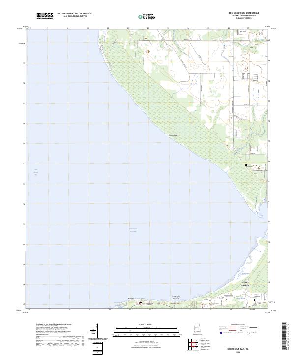
2024 Map of Bon Secour Bay
USGS Topo · Published 2024About this map
Fort Morgan Peninsula separates the vast waters of Bon Secour Bay from the Gulf, creating a complex landscape of coastal wetlands and residential development. This modern survey illustrates the transition from the protected marshes of the Bon Secour National Wildlife Refuge to the expanding street grids of western Gulf Shores. The presence of several family landmarks, including Benton Cem and Shell Banks Cem, indicates the deep roots of local communities like Gasque amidst the shifting shorelines. The Intracoastal Waterway cuts through the bay, serving as a primary maritime artery alongside natural features like Skunk Bayou and Shellbank Bayou. Notable coastal elevations such as Seymour Bluff and landforms like Cypress Point provide structural detail to the low-lying terrain, while the network of county roads and local lanes reflects the modern layout of these historic Alabama shorelines.
Find a feature on this map
52 named features on this map. Tap any name to fly to it.
Don’t see what you’re looking for? This feature index may not catch every label — zoom into the map to look around manually.
Map Details
Editions of this 2024 Bon Secour Bay Map
This is the sole edition of this map. No revisions or reprints were ever made.
Other maps of this area

1921 · Bon Secour
USGS Topo · 1:62,500

1921 · Point Clear
USGS Topo · 1:62,500

1941 · Foley
USGS Topo · 1:62,500

1941 · Weeks Bay
USGS Topo · 1:62,500

1943 · Weeks Bay
USGS Topo · 1:62,500

1943 · Foley
USGS Topo · 1:62,500
1956 · Point Clear
USGS Topo · 1:24,000

1957 · Pensacola
USGS Topo · 1:250,000

1959 · Pensacola
USGS Topo · 1:250,000

1960 · Pensacola
USGS Topo · 1:250,000