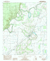
1988 Map of Bonita
USGS Topo · Published 1988About this map
Bonita and the surrounding Morehouse Parish lowlands are defined by an intricate network of waterways and water management infrastructure. The meandering course of Bartholomew Bayou and Bonne Idee Bayou dominate the landscape, with Horseshoe Lake appearing as a prominent oxbow remnant of the river's shifting path. The area's agricultural and transit history is visible through the Missouri Pacific railroad line passing through Jones and the numerous river access points such as Oak Landing, Haynes Landing, and New Lindgrove Landing.
Find a feature on this map
24 named features on this map. Tap any name to fly to it.
Don’t see what you’re looking for? This feature index may not catch every label — zoom into the map to look around manually.
Map Details
Editions of this 1988 Bonita Map
This is the sole edition of this map. No revisions or reprints were ever made.
Other maps of this area

1935 · Wilmot
USGS Topo · 1:62,500

1935 · Naff
USGS Topo · 1:62,500

1935 · Bonita
USGS Topo · 1:62,500

1953 · Greenwood
USGS Topo · 1:250,000

1955 · Jackson
USGS Topo · 1:250,000

1956 · Greenwood
USGS Topo · 1:250,000

1956 · Bastrop
USGS Topo · 1:62,500

1958 · Bonita
USGS Topo · 1:62,500

1960 · Wilmot
USGS Topo · 1:62,500
1960 · Wilmot
USGS Topo · 1:24,000