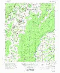
1958 Map of Bonita
USGS Topo · Published 1974About this map
Bayou Bartholomew and the Boeuf River dominate this landscape in northeast Morehouse Parish, where a intricate network of waterways like Bonne Idee Bayou and Cypress Bayou once dictated the layout of rural life. The Missouri Pacific railroad serves as a central spine for the agricultural settlements of Bonita and Jones, while the surrounding timber and cotton lands are dotted with numerous community anchors. Genealogists will find a wealth of local landmarks, including the McGinty Sch and Johnson Sch, alongside nearly two dozen country churches such as Victory Missionary Ch and New St Mary Ch. Of particular note is the Head of Navigation marker on the Boeuf River at the Morehouse Parish and West Carroll Parish line, indicating the historical reach of river transport into the Louisiana interior during this era.
Find a feature on this map
55 named features on this map. Tap any name to fly to it.
Don’t see what you’re looking for? This feature index may not catch every label — zoom into the map to look around manually.
Map Details
Editions of this 1958 Bonita Map
2 editions found

Other maps of this area

1935 · Collinston
USGS Topo · 1:62,500

1935 · Wilmot
USGS Topo · 1:62,500

1935 · Naff
USGS Topo · 1:62,500

1935 · Hurricane
USGS Topo · 1:62,500

1935 · Oak Grove
USGS Topo · 1:62,500

1935 · Bonita
USGS Topo · 1:62,500

1936 · Eudora
USGS Topo · 1:62,500

1953 · Greenwood
USGS Topo · 1:250,000

1955 · Jackson
USGS Topo · 1:250,000

1956 · Greenwood
USGS Topo · 1:250,000