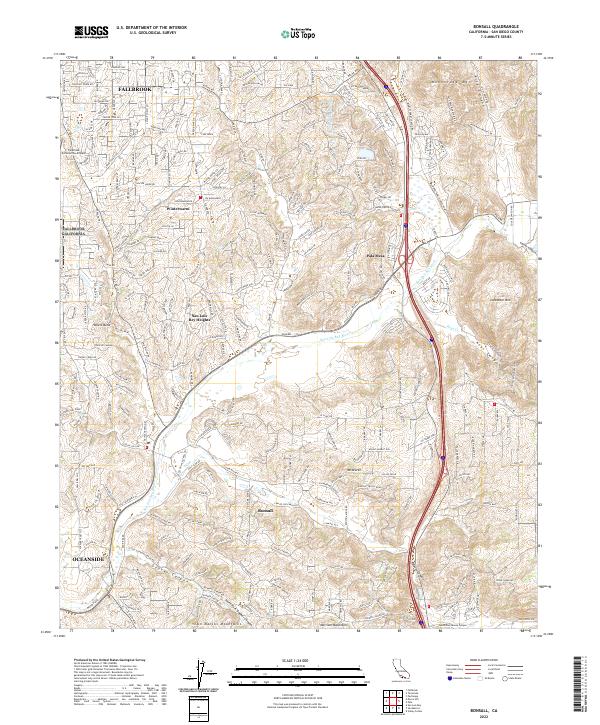
2022 Map of Bonsall
USGS Topo · Published 2022About this map
Fallbrook and Bonsall anchor this inland San Diego County landscape, characterized by the winding path of the San Luis Rey River and the critical infrastructure of the Second San Diego Aqueduct. The terrain is defined by dramatic elevation changes, from the heights of Monserate Mtn and Lancaster Mtn to the deep cuts of Gopher Canyon and Keys Canyon. This 2022 survey illustrates the modern residential expansion of communities like Winterwarm, Pala Mesa, and San Luis Rey Heights, which are linked by a complex network of roads including Pala Rd 76 and W Lilac Rd. The presence of the Fallbrook Community Airpark on the western edge and the various mountain ranges, such as the San Marcos Mountains and Merriam Mountains to the south, highlight the intersection of suburban development and the challenging topography of the Peninsular Ranges.
Find a feature on this map
39 named features on this map. Tap any name to fly to it.
Don’t see what you’re looking for? This feature index may not catch every label — zoom into the map to look around manually.
Map Details
Editions of this 2022 Bonsall Map
This is the sole edition of this map. No revisions or reprints were ever made.
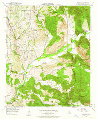
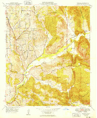
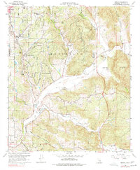
Historical Maps of Rainbow Through Time
4 maps found