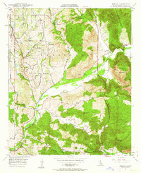
1948 Map of Bonsall
USGS Topo · Published 1963About this map
San Luis Rey River flows through the heart of this landscape, defining the settlement patterns of Northern San Diego County just after the war. The map reveals an area transitioning from traditional ranching to more structured rural development, with large holdings like Rancho San Luis Rey and Rancho Viejo sitting alongside established enclaves like Bonsall and the hilltop San Luis Rey Heights. The interior is marked by significant elevation changes, from the heights of Monserate Mountain and Mt Ararat down into the winding depths of Moosa Canyon and Gopher Canyon. To the northwest, the edge of the Fallbrook Naval Reservation indicates the nearby military presence, while infrastructure like the Lang Pumping Sta and Gird Pumping Sta highlights the vital role of water management in this Mediterranean climate. Local education is anchored at Duffy Ranch Sch, serving the families who lived along winding routes such as Pala Road and Live Oak Park Road.
Find a feature on this map
31 named features on this map. Tap any name to fly to it.
Don’t see what you’re looking for? This feature index may not catch every label — zoom into the map to look around manually.
Map Details
Editions of this 1948 Bonsall Map
2 editions found
Other maps of this area

1893 · Oceanside
USGS Topo · 1:62,500

1893 · Escondido
USGS Topo · 1:62,500

1898 · Oceanside
USGS Topo · 1:62,500

1901 · Escondido
USGS Topo · 1:62,500

1901 · Oceanside
USGS Topo · 1:62,500

1901 · San Luis Rey
USGS Topo · 1:125,000

1904 · Southern California Sheet No. 2
USGS Topo · 1:250,000

1941 · Margarita Peak
USGS Topo · 1:62,500

1942 · Margarita Peak
USGS Topo · 1:62,500

1942 · Temecula
USGS Topo · 1:62,500