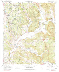
1968 Map of Bonsall
USGS Topo · Published 1977About this map
The San Luis Rey River carves a broad valley through the center of this terrain, serving as the geographic anchor for the community of Bonsall and its surrounding agricultural reaches. In the late 1960s, this area of San Diego County was characterized by a mix of established ranching operations, such as Dulin Ranch and Circle R Ranch, and emerging residential enclaves like San Luis Rey Heights and Winterwarm. The northern uplands are dominated by the heights of Monserate Mountain, while the southern portion features the winding courses of Moosa Canyon and Gopher Canyon. Transportation and infrastructure are concentrated along historical routes like Stagecoach Road and Mission Road, which link the various pockets of settlement and recreation, including the Pala Mesa Golf Club, providing a clear view of the region's mid-century development before more intensive modern expansion.
Find a feature on this map
32 named features on this map. Tap any name to fly to it.
Don’t see what you’re looking for? This feature index may not catch every label — zoom into the map to look around manually.
Map Details
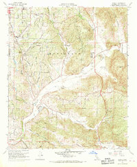
Editions of this 1968 Bonsall Map
3 editions found
Other maps of this area

1893 · Oceanside
USGS Topo · 1:62,500

1893 · Escondido
USGS Topo · 1:62,500

1898 · Oceanside
USGS Topo · 1:62,500

1901 · Escondido
USGS Topo · 1:62,500

1901 · Oceanside
USGS Topo · 1:62,500

1901 · San Luis Rey
USGS Topo · 1:125,000

1904 · Southern California Sheet No. 2
USGS Topo · 1:250,000

1941 · Margarita Peak
USGS Topo · 1:62,500

1942 · Margarita Peak
USGS Topo · 1:62,500

1942 · Temecula
USGS Topo · 1:62,500