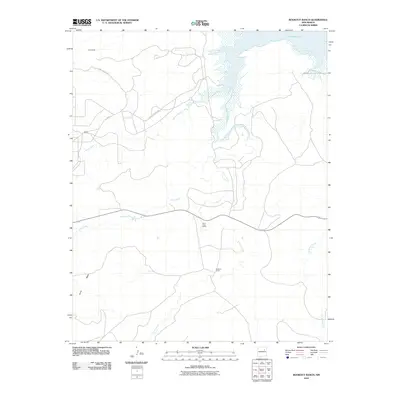
2010 Map of Bookout Ranch
USGS Topo · Published 2010About this map
Bookout Ranch anchors this high-plains landscape where ranching life and mineral interests meet at the turn of the 21st century. The map depicts a sparse network of county roads, including County Road C-59 and Co Rd 58, which connect isolated outposts like Allemando and Maxey to the wider San Miguel County area. The terrain is defined by the elevation of North Mesa and a drainage system that feeds toward the northern waters of Conchas Lake.
Find a feature on this map
13 named features on this map. Tap any name to fly to it.
Don’t see what you’re looking for? This feature index may not catch every label — zoom into the map to look around manually.
Map Details
Editions of this 2010 Bookout Ranch Map
This is the sole edition of this map. No revisions or reprints were ever made.
Other maps of this area

1954 · Santa Fe
USGS Topo · 1:250,000

1958 · Santa Fe
USGS Topo · 1:250,000

1963 · Mesita Del Gato
USGS Topo · 1:24,000

1964 · Neafus Ranch
USGS Topo · 1:24,000

1964 · Ortega Tank
USGS Topo · 1:24,000

1967 · Tenaja Mesa
USGS Topo · 1:24,000

1968 · Conchas Dam
USGS Topo · 1:24,000

1972 · Variadero
USGS Topo · 1:24,000

1972 · Four V Ranch
USGS Topo · 1:24,000

1972 · La Silla
USGS Topo · 1:24,000