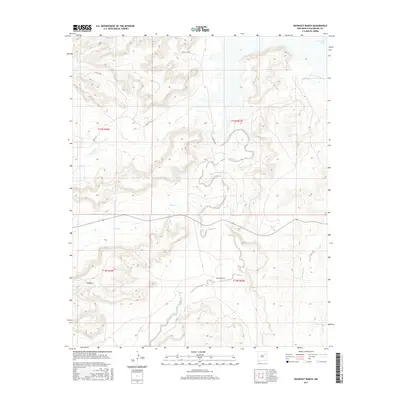
2017 Map of Bookout Ranch
USGS Topo · Published 2017About this map
Bookout Ranch sits at the heart of this high-plains landscape in San Miguel County, where ranching life is defined by the drainage of winding arroyos. The terrain is marked by the prominent elevation of N Mesa, with the land falling away toward the seasonal waters of Cuervo Cr and Pino Cr. These intermittent streams eventually flow toward the eastern reach of the map where the shoreline of Conchas Lake appears, reflecting the importance of water management in this arid environment. The road network, including Magnolia Rd and Aztec Vista Dr, illustrates the modern access points into these traditional grazing lands. Further south, La Manga Cr and Garita Cr cut through the topography, showing the natural erosion patterns that have shaped the ranching boundaries of the region for generations.
Find a feature on this map
16 named features on this map. Tap any name to fly to it.
Don’t see what you’re looking for? This feature index may not catch every label — zoom into the map to look around manually.
Map Details
Editions of this 2017 Bookout Ranch Map
This is the sole edition of this map. No revisions or reprints were ever made.
Other maps of this area

1954 · Santa Fe
USGS Topo · 1:250,000

1958 · Santa Fe
USGS Topo · 1:250,000

1963 · Mesita Del Gato
USGS Topo · 1:24,000

1964 · Neafus Ranch
USGS Topo · 1:24,000

1964 · Ortega Tank
USGS Topo · 1:24,000

1967 · Tenaja Mesa
USGS Topo · 1:24,000

1968 · Conchas Dam
USGS Topo · 1:24,000

1972 · Variadero
USGS Topo · 1:24,000

1972 · Four V Ranch
USGS Topo · 1:24,000

1972 · La Silla
USGS Topo · 1:24,000