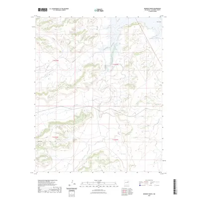
2023 Map of Bookout Ranch
USGS Topo · Published 2023About this map
Pino Creek and Garita Creek carve through the high plains of San Miguel County in this modern topographic study. The landscape is defined by the drainage patterns of these waterways and their tributaries, including Cuervo Creek and La Manga Creek, which shape the transition from flat tablelands to complex canyon systems. The map details a sparse network of rural routes such as Aztec Vista Rd, Magnolia Rd, and various county roads that provide access to the expansive ranchlands of eastern New Mexico.
Find a feature on this map
15 named features on this map. Tap any name to fly to it.
Don’t see what you’re looking for? This feature index may not catch every label — zoom into the map to look around manually.
Map Details
Editions of this 2023 Bookout Ranch Map
This is the sole edition of this map. No revisions or reprints were ever made.
Other maps of this area

1954 · Santa Fe
USGS Topo · 1:250,000

1958 · Santa Fe
USGS Topo · 1:250,000

1963 · Mesita Del Gato
USGS Topo · 1:24,000

1964 · Neafus Ranch
USGS Topo · 1:24,000

1964 · Ortega Tank
USGS Topo · 1:24,000

1967 · Tenaja Mesa
USGS Topo · 1:24,000

1968 · Conchas Dam
USGS Topo · 1:24,000

1972 · Variadero
USGS Topo · 1:24,000

1972 · Four V Ranch
USGS Topo · 1:24,000

1972 · La Silla
USGS Topo · 1:24,000