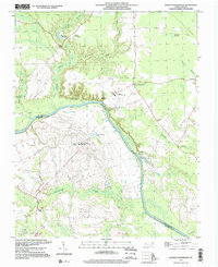
1997 Map of Boones Crossroads
USGS Topo · Published 2000About this map
The Roanoke River carves a winding path through this region of the coastal plain, marking the border between Northampton Co and Halifax Co. The landscape is defined by vast lowland drainage systems, including Gumberry Swamp, Conocanara Swamp, and Urahaw Swamp, interspersed with small agrarian communities and institutional land holdings. Significant portions of the riverbank are occupied by large-scale facilities such as the Caledonia State Prison Farm and Odom State Prison Farm, which dominate the local geography alongside water management features like the Sewage Disposal Ponds.
Find a feature on this map
26 named features on this map. Tap any name to fly to it.
Don’t see what you’re looking for? This feature index may not catch every label — zoom into the map to look around manually.
Map Details
Editions of this 1997 Boones Crossroads Map
This is the sole edition of this map. No revisions or reprints were ever made.
Other maps of this area

1953 · Norfolk
USGS Topo · 1:250,000

1960 · Dawson Crossroads
USGS Topo · 1:24,000

1962 · Scotland Neck
USGS Topo · 1:24,000

1962 · Norfleet
USGS Topo · 1:24,000

1974 · Halifax
USGS Topo · 1:24,000

1974 · Boones Crossroads
USGS Topo · 1:24,000

1974 · Rich Square
USGS Topo · 1:24,000
1974 · Weldon
USGS Topo · 1:24,000
1974 · Jackson
USGS Topo · 1:24,000
1975 · Galatia
USGS Topo · 1:24,000