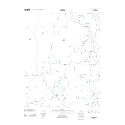
2013 Map of Boonsboro
USGS Topo · Published 2013About this map
Eagles Eyrie and the sprawling Eagle Eyrie Virginia Baptist Assembly dominate the northern landscape of this region as it appeared in the early 21st century. The topography is defined by significant peaks including Rocky Mountain, Fleming Mountain, and Dolly Mountain, which overlook a network of creek valleys and small settlements. The area shows a distinct pattern of residential development radiating from Boonsboro and along the corridors of Coffee and Perrowville, where suburban road networks begin to intertwine with rural landscapes.
Find a feature on this map
152 named features on this map. Tap any name to fly to it.
Don’t see what you’re looking for? This feature index may not catch every label — zoom into the map to look around manually.
Map Details
Editions of this 2013 Boonsboro Map
This is the sole edition of this map. No revisions or reprints were ever made.
Other maps of this area

1892 · Lynchburg
USGS Topo · 1:125,000

1894 · Lexington
USGS Topo · 1:125,000

1935 · Buena Vista
USGS Topo · 1:48,000

1935 · Amherst
USGS Topo · 1:48,000

1939 · Amherst
USGS Topo · 1:62,500

1939 · Buena Vista
USGS Topo · 1:62,500

1940 · Buena Vista
USGS Topo · 1:62,500

1944 · Lynchburg
USGS Topo · 1:62,500

1947 · Roanoke
USGS Topo · 1:250,000

1950 · Goode
USGS Topo · 1:62,500