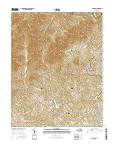
2016 Map of Boonsboro
USGS Topo · Published 2016About this map
Lynchburg and its northwestern environs are defined by the sharp transition from the Piedmont foothills to the rising peaks of the Blue Ridge, with the James River carving the northern border near Coleman Falls. The landscape is a network of ridges and drainage basins, where Judith Cr, Ivy Cr, and Cheese Cr flow through deeply dissected terrain. Settlements like Boonsboro and Coffee serve as local hubs for the rural residential growth extending from the city, while higher elevations are marked by distinctive peaks such as No Business Mtn, Round Mtn, and Grassy Mtn. Genealogical interest is concentrated in the southern portion of the quadrangle near Norwood, where several burial grounds including Norwood Cem, North Cem, and Grange Cem are located near Bethany Church. The map also illustrates the dividing line between Amherst and Bedford Counties as it follows the river's course, highlighting the historical importance of the water gap to regional transport and land boundaries.
Find a feature on this map
137 named features on this map. Tap any name to fly to it.
Don’t see what you’re looking for? This feature index may not catch every label — zoom into the map to look around manually.
Map Details
Editions of this 2016 Boonsboro Map
This is the sole edition of this map. No revisions or reprints were ever made.
Other maps of this area

1892 · Lynchburg
USGS Topo · 1:125,000

1894 · Lexington
USGS Topo · 1:125,000

1935 · Buena Vista
USGS Topo · 1:48,000

1935 · Amherst
USGS Topo · 1:48,000

1939 · Amherst
USGS Topo · 1:62,500

1939 · Buena Vista
USGS Topo · 1:62,500

1940 · Buena Vista
USGS Topo · 1:62,500

1944 · Lynchburg
USGS Topo · 1:62,500

1947 · Roanoke
USGS Topo · 1:250,000

1950 · Goode
USGS Topo · 1:62,500