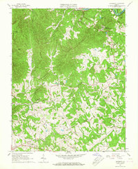
1965 Map of Boonsboro
USGS Topo · Published 1967About this map
No Business Mountain and Fleming Mountain dominate this mid-century topographic portrait of the area northwest of Lynchburg. The landscape is defined by the winding course of the James River along the northern border, where the Chesapeake and Ohio railroad tracks follow the river's path through Coleman Falls. The interior is dotted with rural community life, featuring numerous small congregations like Trinity Ch and Alpha Grove Ch, along with the Eagle Eyrie Va Baptist Assembly perched near the heights of Locke Mtn. The transition from the more developed corridor near the Boonsboro Country Club in the east to the more secluded ridges of Dolly Mountain and Grassy Mountain in the west illustrates the varied geography of the Amherst and Bedford county line during the mid-1960s.
Find a feature on this map
43 named features on this map. Tap any name to fly to it.
Don’t see what you’re looking for? This feature index may not catch every label — zoom into the map to look around manually.
Map Details
Editions of this 1965 Boonsboro Map
2 editions found
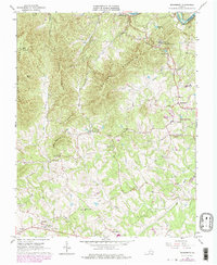
Other maps of this area

1892 · Lynchburg
USGS Topo · 1:125,000

1894 · Lexington
USGS Topo · 1:125,000

1935 · Buena Vista
USGS Topo · 1:48,000

1935 · Amherst
USGS Topo · 1:48,000

1939 · Amherst
USGS Topo · 1:62,500

1939 · Buena Vista
USGS Topo · 1:62,500

1940 · Buena Vista
USGS Topo · 1:62,500

1944 · Lynchburg
USGS Topo · 1:62,500

1947 · Roanoke
USGS Topo · 1:250,000

1950 · Goode
USGS Topo · 1:62,500