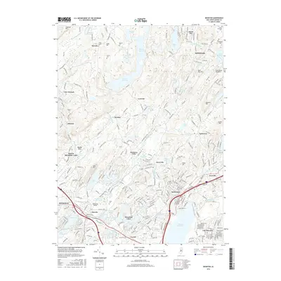
2016 Map of Boonton
USGS Topo · Published 2016About this map
Boonton and its namesake reservoir anchor this northern New Jersey landscape, which is defined by a dense concentration of glacial lakes and mountain ridges. The terrain transitions from the developed corridors of Denville and Lake Hiawatha to the high ground of Copperas Mtn and Pyramid Mtn. A significant cluster of historical cemeteries, including Union Chapel Cem, Marcella Cem, and Hibernia Cem, suggests a long-settled rural history that predates the modern suburban expansion. Large water bodies like Splitrock Reservoir and the Boonton Reservoir dominate the hydrology, while numerous smaller ponds like The Tarn and Dixons Pond are scattered throughout the valleys. The map documents the intricate road network of the Morris County Highlands, showing the established communities of Hibernia, Montville, and Kinnelon as they integrated into the larger metropolitan area by the mid-2010s.
Find a feature on this map
297 named features on this map. Tap any name to fly to it.
Don’t see what you’re looking for? This feature index may not catch every label — zoom into the map to look around manually.
Map Details
Editions of this 2016 Boonton Map
This is the sole edition of this map. No revisions or reprints were ever made.
Other maps of this area

1888 · Franklin
USGS Topo · 1:62,500

1888 · Morristown
USGS Topo · 1:62,500

1888 · Lake Hopatcong
USGS Topo · 1:62,500

1891 · Greenwood Lake
USGS Topo · 1:62,500

1893 · Greenwood Lake
USGS Topo · 1:62,500

1894 · Morristown
USGS Topo · 1:62,500

1894 · Lake Hopatcong
USGS Topo · 1:62,500

1894 · Franklin
USGS Topo · 1:62,500

1897 · Franklin
USGS Topo · 1:62,500

1898 · Lake Hopatcong
USGS Topo · 1:62,500
Featured Places
- Parsippany-Troy Hills, NJ
- Rockaway Township, NJ
- Montville Township, NJ
- Denville Township, Denville
- Denville, NJ